Summary
- High-grade, silver, copper, lead and zinc associated with quartz-carbonate veining
- First discovered in 2016 with ~$7,600,000 spent to date
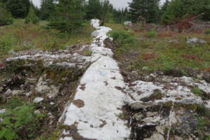
- 12 km linear soil anomaly with grades in soil of up to 657 g/t silver and 0.68% copper1
- 16,000m of drilling has led to 400m x 200m x 150m Heimdall zone within a 1km footprint of near surface high grade veining
1 - As reported by Altius Resources Inc. and Latin American Minerals Inc. in a technical report entitled “NI 43-101 Technical Report on the Sail Pond Project, Great Northern Pensinsula, Newfoundland, Canada”, prepared by Stephen J. Piercey, Ph.D., of Stephen J. Piercey Geological Consulting, dated September 16, 2020. Sample 17891, Certificate EA706-2024358.
Location and Ownership
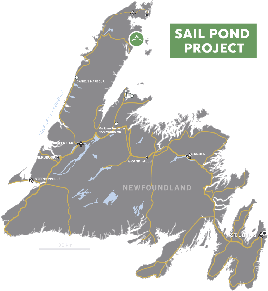
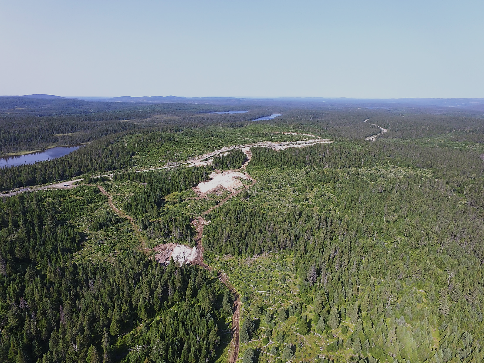
- 13,500 Ha project located on Newfoundland’s Great Northern Peninsula, eastern Canada
- Easily accessible by a series of paved highways, forest access roads and trails
- Adjacent to many regional services and within 32 km of the St. Anthony regional airport
- 100% owned. Subject to a 2% NSR
Geological Setting
- High-grade Ag plus Cu-Pb-Zn-Sb (± Au) mineralization found at Sail Pond unique for eastern Canada
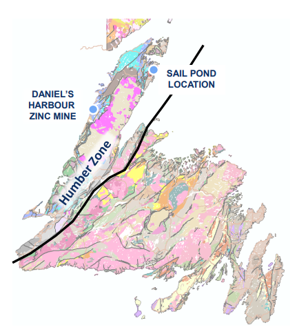
- Laurentian Margin – Humber Tectonostratigraphic Zone
- Geology records a prolonged geological history as part of the Appalachian Orogenic cycle
- Active to passive margin environments represented by Early Cambrian to Middle Ordovician rift-related siliciclastics to platformal carbonates
- Parautochthonous and allochthonous displacement resulting in westward verging folds, NE orientated thrust faults, and shear zones
- Dominantly carbonate-hosted Zn ± Pb, Ag occurrences in the region; e.g. Daniel’s Harbour – 7 Mt @ 7.8% Zn (mined between 1975-1990); minor Cu occurrences1
- Mineralization is stratabound; occurring in brittle deformed Lower to Mid-Ordovician dolostone; restricted to the western portion of the White Arm Window doubly plunging anticline; bounded and adjacent to major thrust/shear zones
1 - As disclosed in a report prepared by Altius Resources Inc. and Latin American Minerals Inc. in a technical report entitled “NI 43-101 Technical Report on the Sail Pond Project, Great Northern Pensinsula, Newfoundland, Canada”, prepared by Stephen J. Piercey, Ph.D., of Stephen J. Piercey Geological Consulting, dated September 16, 2020.
Mineralization
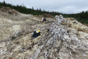
- High-grade Ag plus Cu-Pb-Zn-Sb (± Au) mineralization within four major zones along a 14 km trend; up to 200 m wide; remains open to the north, south, and at depth
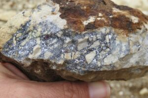
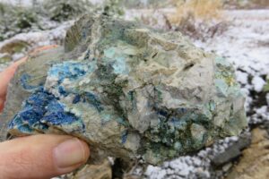
- Primary sulphide species include tetrahedrite, sphalerite, galena, and boulangerite; secondary (supergene) minerals include chalcocite, bornite, covellite, and malachite
- Silica ± calcite ± sericite alteration
- Mineralization is generally within, or spatially associated with quartz-carbonate veins, occurs as open-space infilling (clots), disseminations, vein-parallel massive bands or veinlets, and as solution breccia matrix replacement
- Centimeter to meter-scale width quartz-carbonate veins form a conjugate set of steeply dipping veins that are oriented NE-SW, cross-cut by E-W veins; related to D2 (transtensional) and D4 (compressional) deformation events
Qualified Person's Statement
Jeremy Niemi, P.Geo., Senior Vice President of Exploration and Evaluation to Sterling Metals, and a Qualified Person within the meaning of National Instrument 43-101 Standards of Disclosure for Minerals Projects, has reviewed and approved the technical information presented herein.